Beskid Mały - Photos of signposts on mountain trails
Beskid Mały
 Chatka Gibasówka (800 m)
1
 Chatka pod Potrójną (800 m)

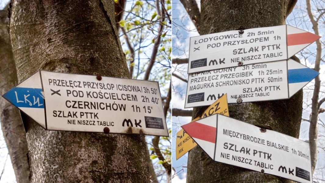
 Cisowa Przełęcz (805 m)
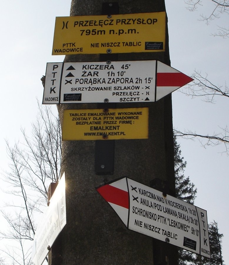

 Czartak (286 m)
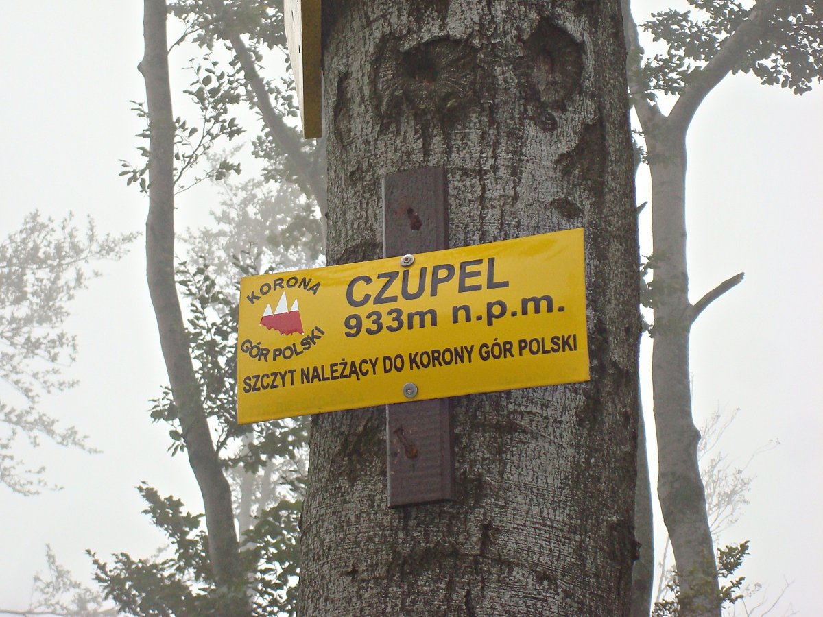
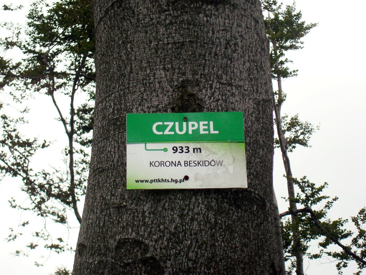
 Czupel (934 m)
1

2


 Diabli Kamień (588 m)
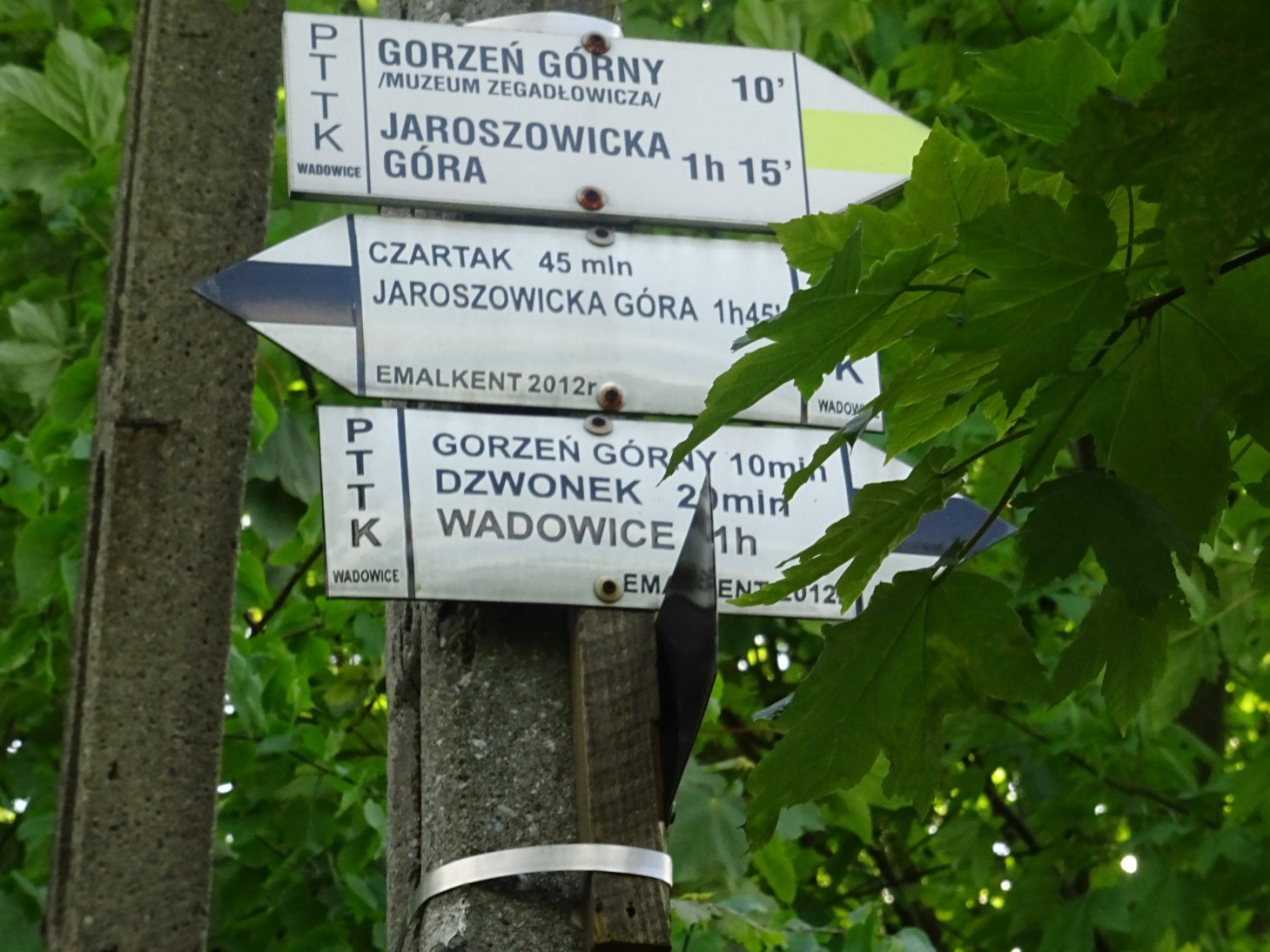
 Gorzeń Górny (360 m)


 Hrobacza Łąka (828 m)
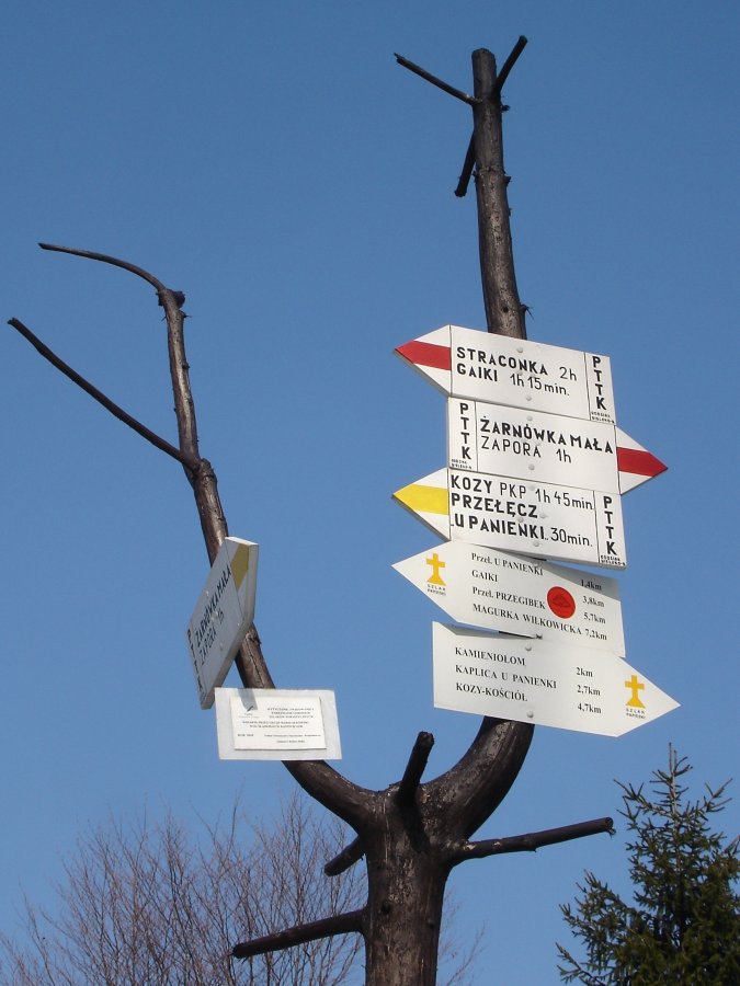
 Jagódki (479 m)
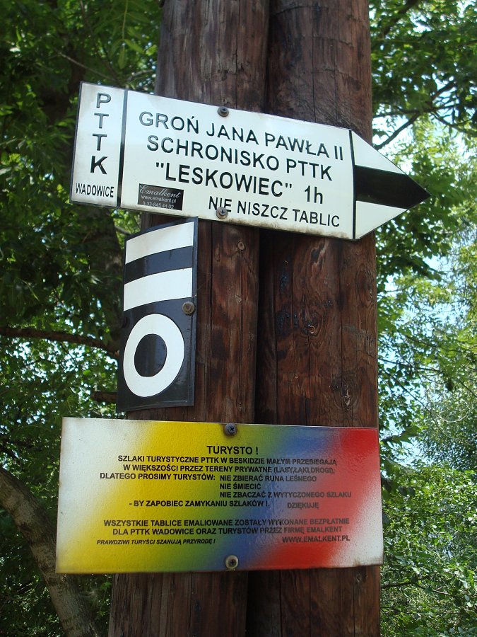


 Kaczyna (396 m)
 Kocoń (545 m)
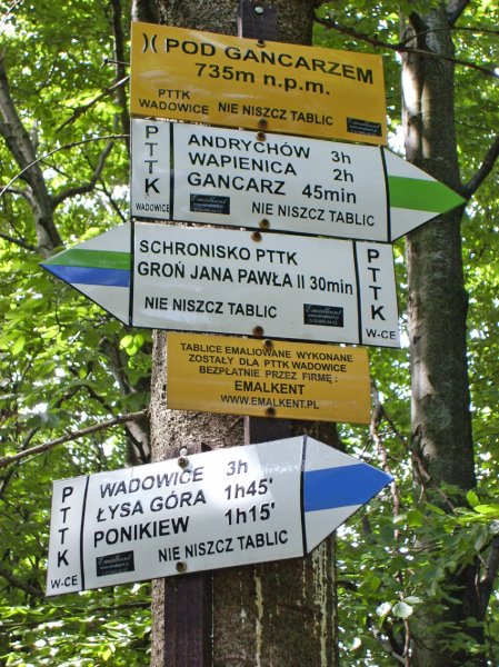
 Kościelec (735 m)
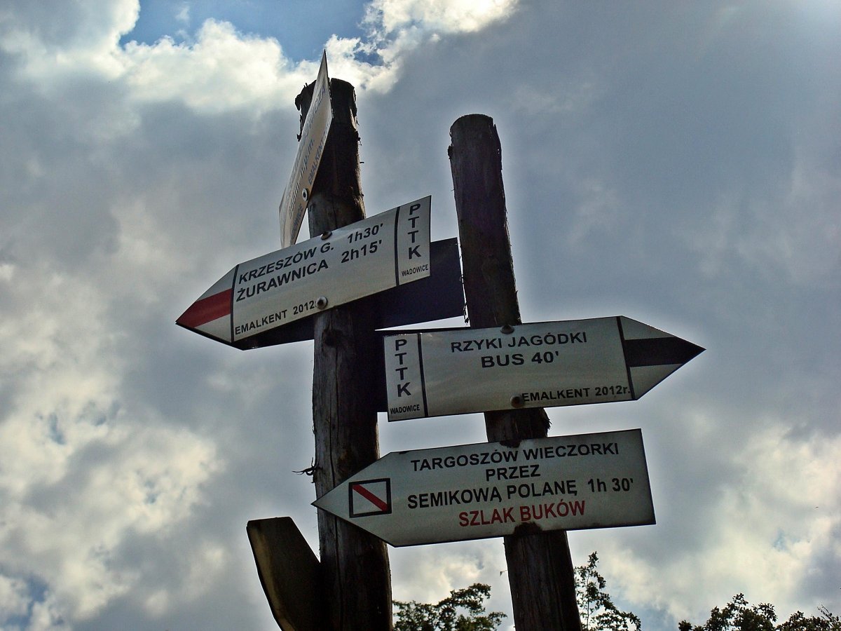
 Krzeszów Górny (500 m)

 Łamana Skała (888 m)


 Łodygowice (374 m)
 Łysa Góra (502 m)
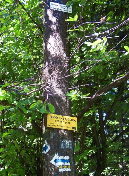
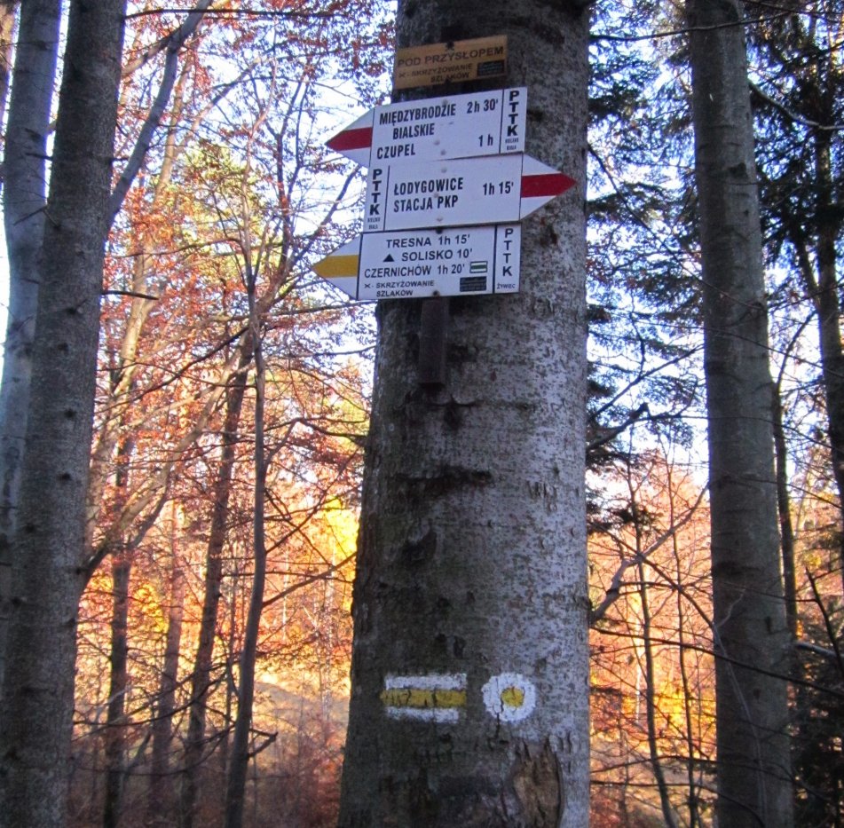
 Międzybrodzie Bialskie (334 m)
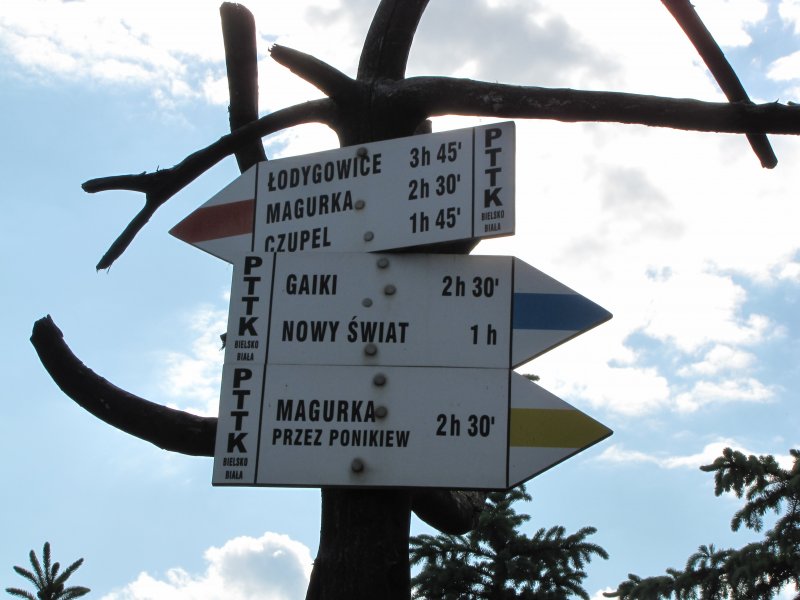
 Międzybrodzie Żywieckie (380 m)
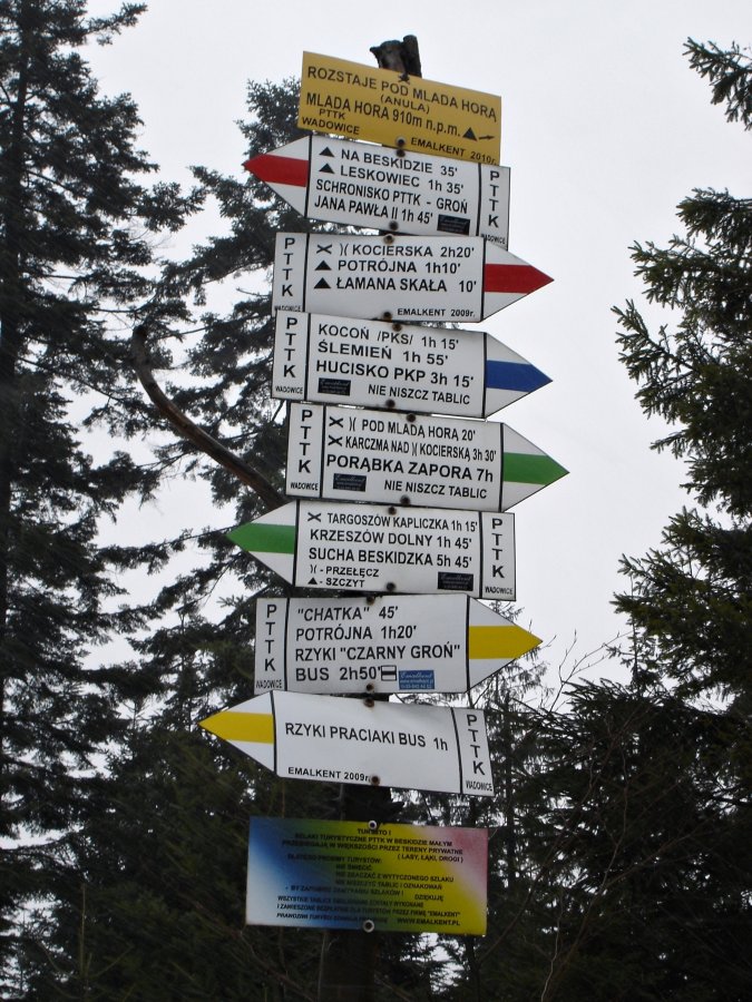
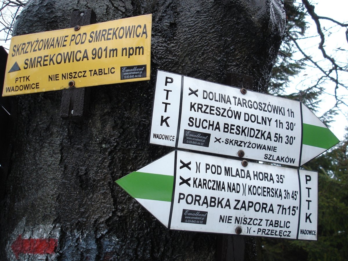
 Młada Hora (872 m)
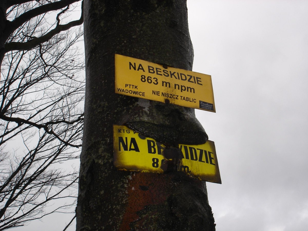
 Ostry Wierch (522 m)
 Podlas (500 m)
 Ponikiew (390 m)
 Porąbka (320 m)

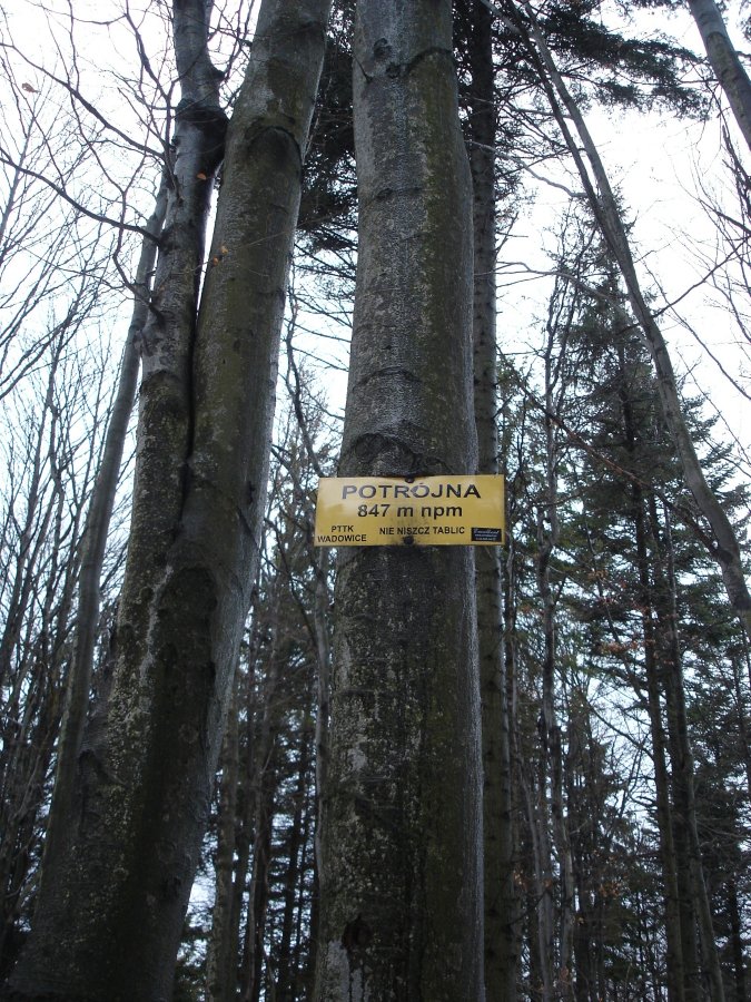
 Potrójna (883 m)


 Przegibek (663 m)
1


 Przełęcz Isepnicka (698 m)
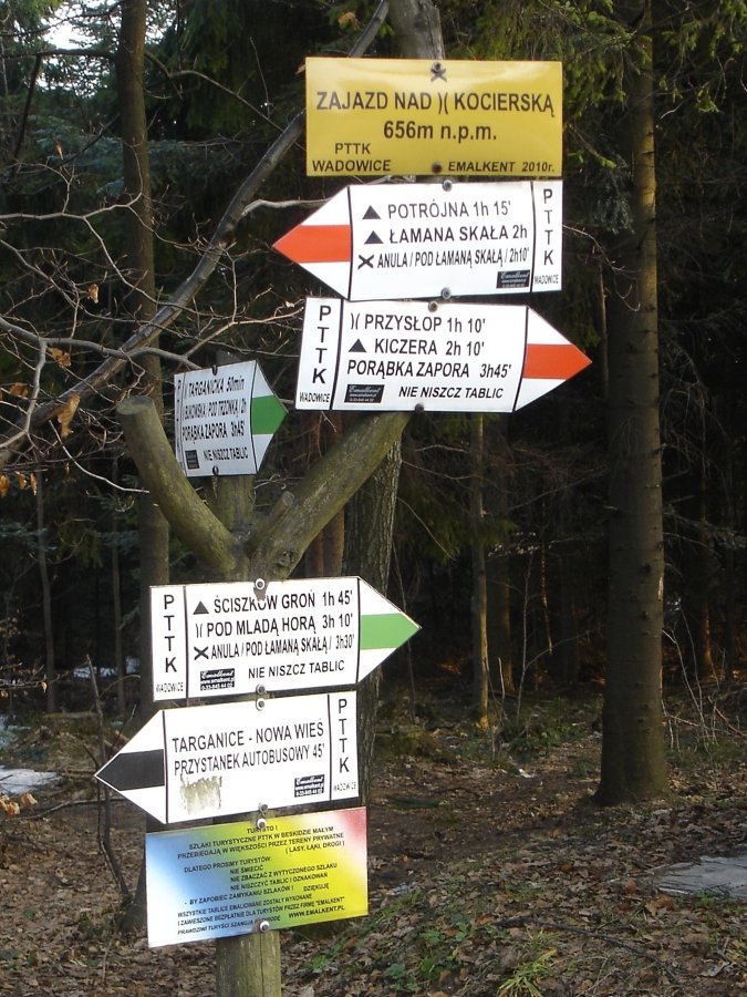
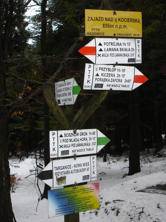
 Przełęcz Kocierska (756 m)
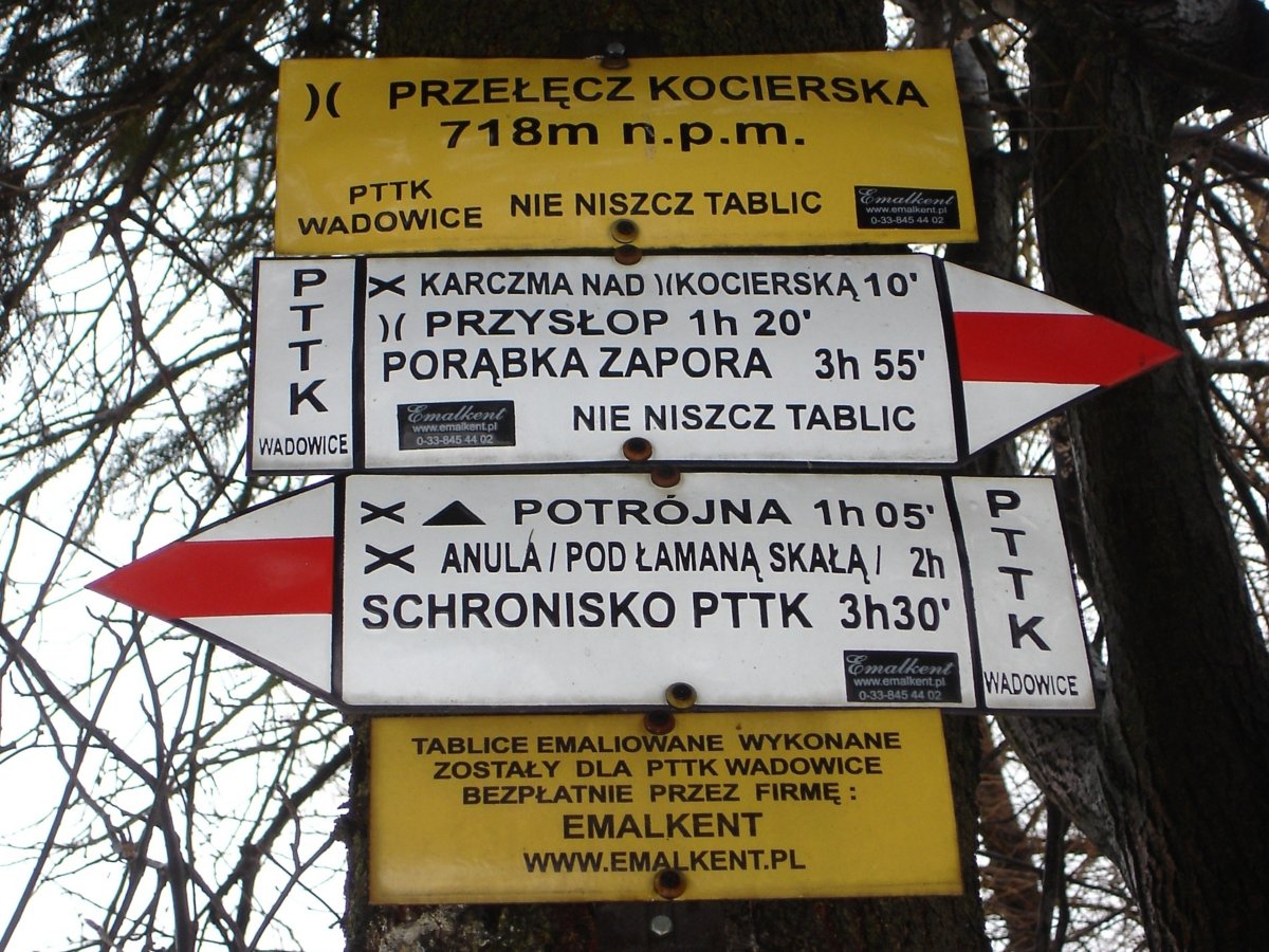


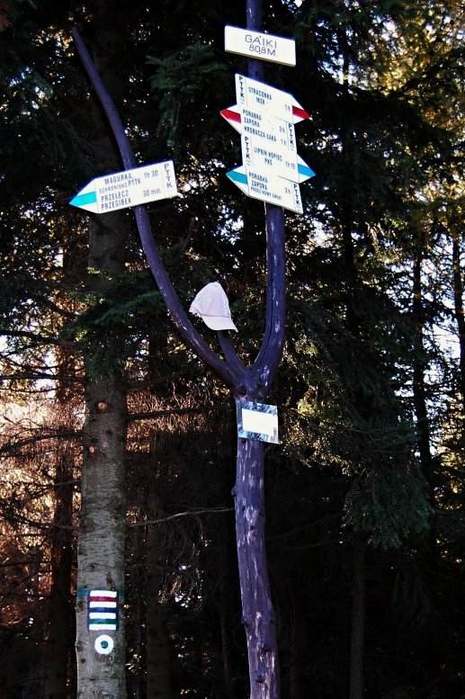
 Przełęcz między Gaikami i Groniczkami (800 m)

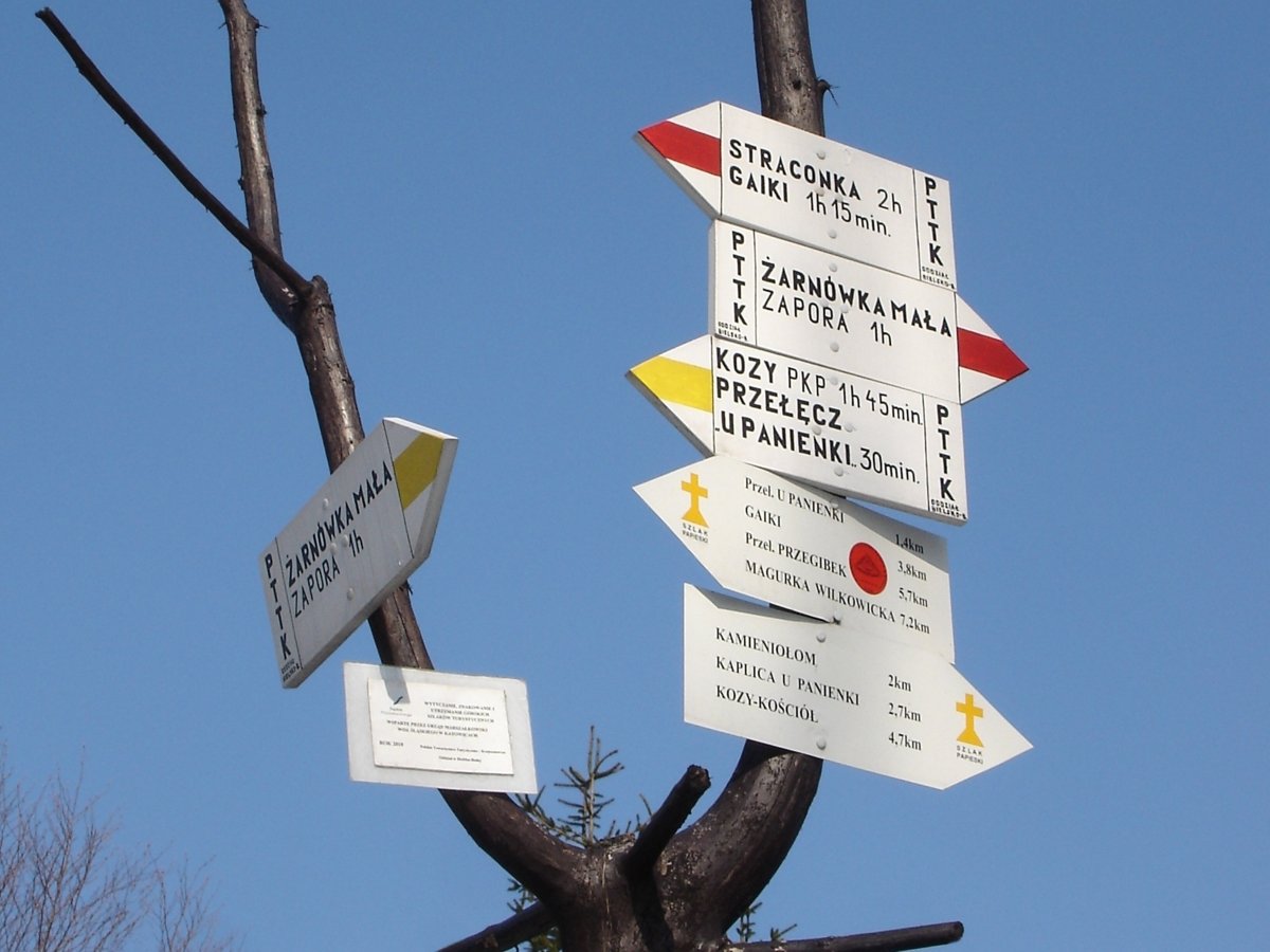
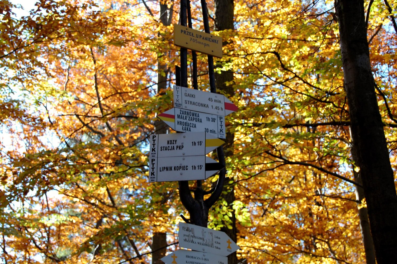
 Przełęcz u Panienki (710 m)
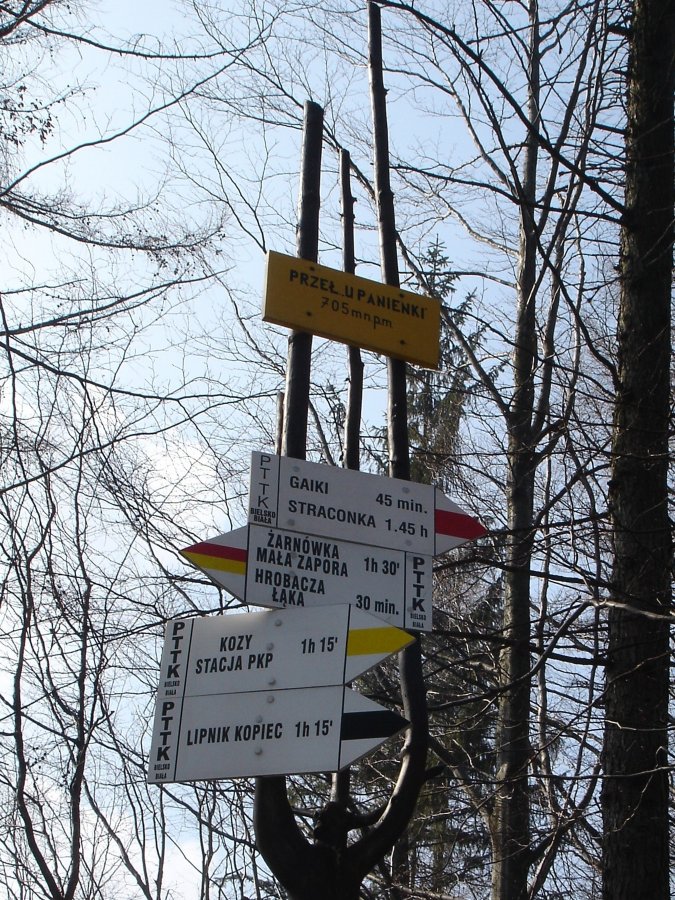
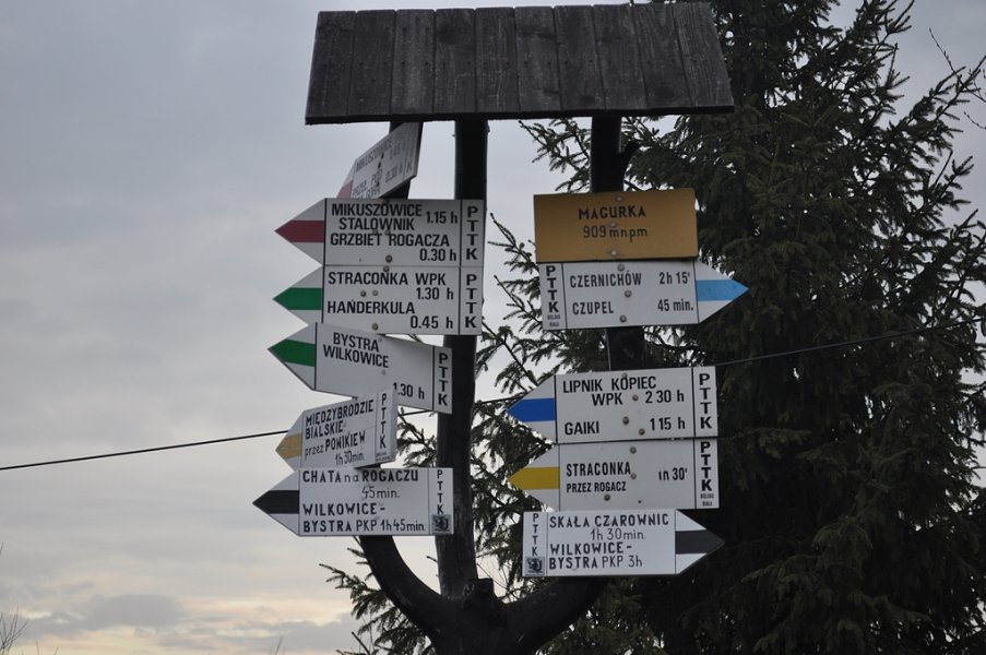
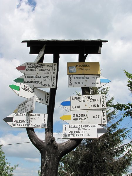
 Schronisko PTTK Magurka Wilkowicka (909 m)


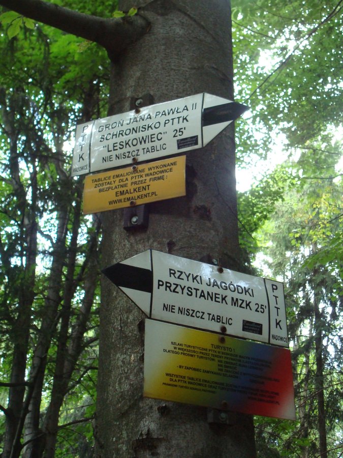
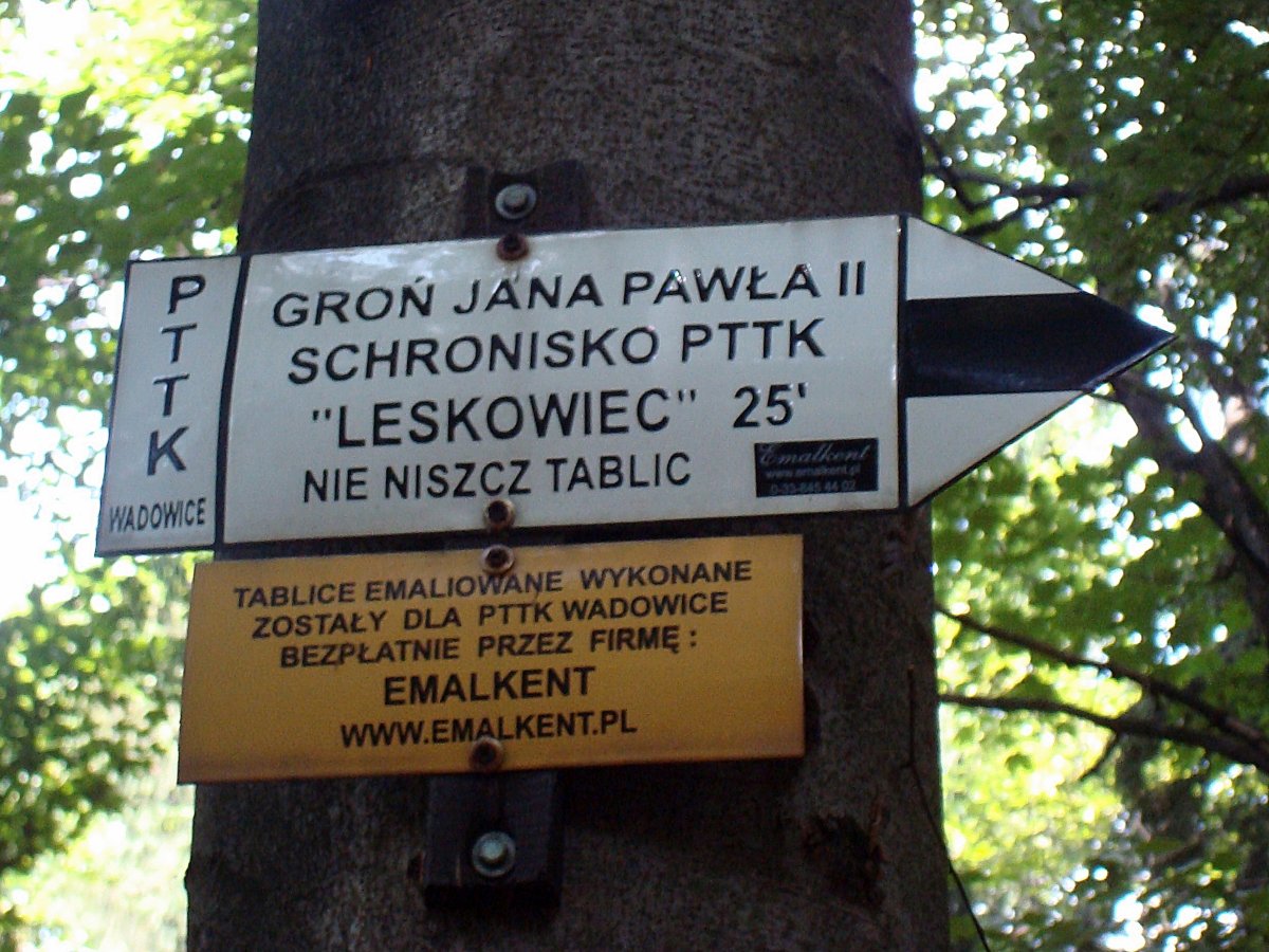
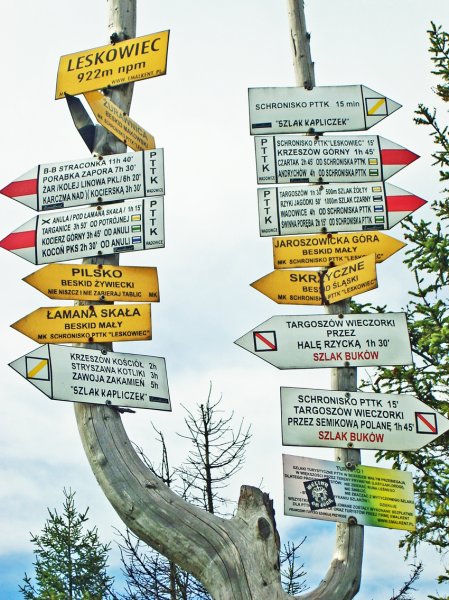
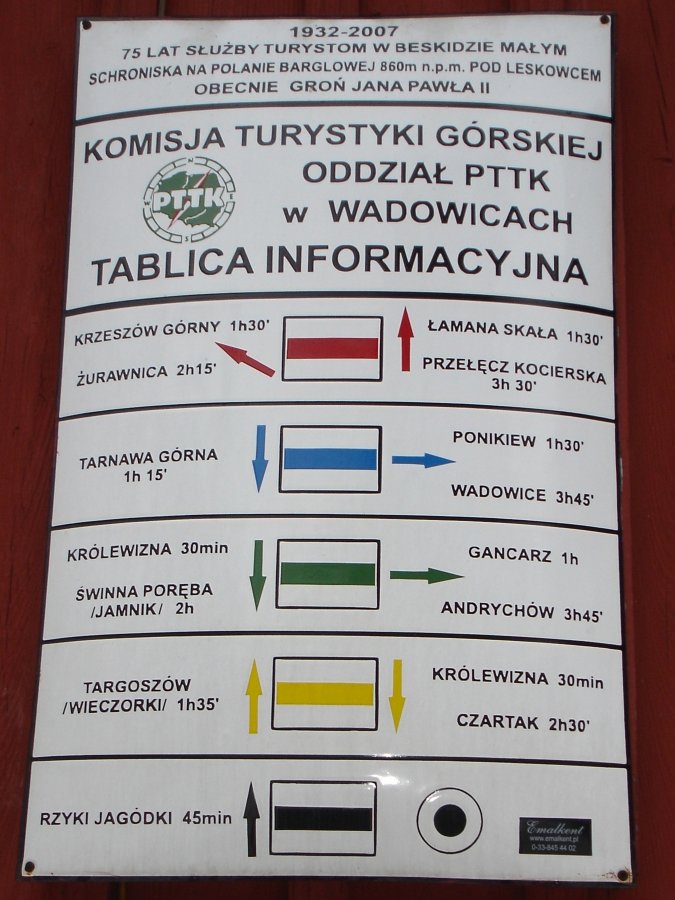
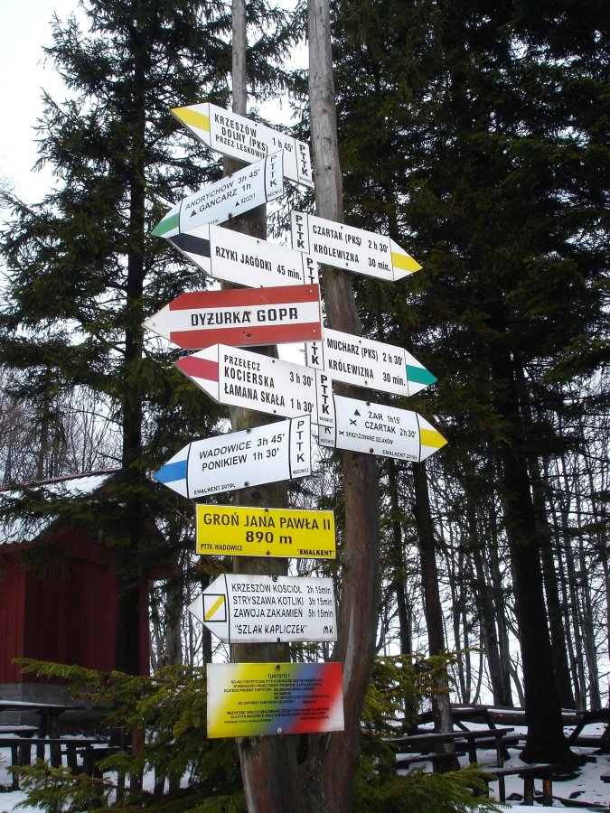
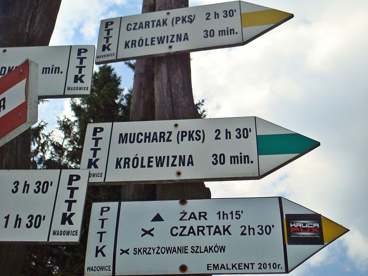
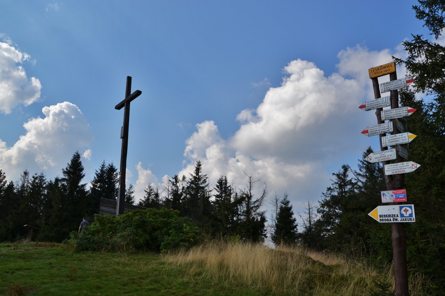
 Schronisko PTTK na Leskowcu / Groń Jana Pawła II (890 m)
1


1


 Siodło (Prz.Łysa) (585 m)
 Straconka (430 m)
 Świnna Poręba (314 m)
 Wadowice (266 m)
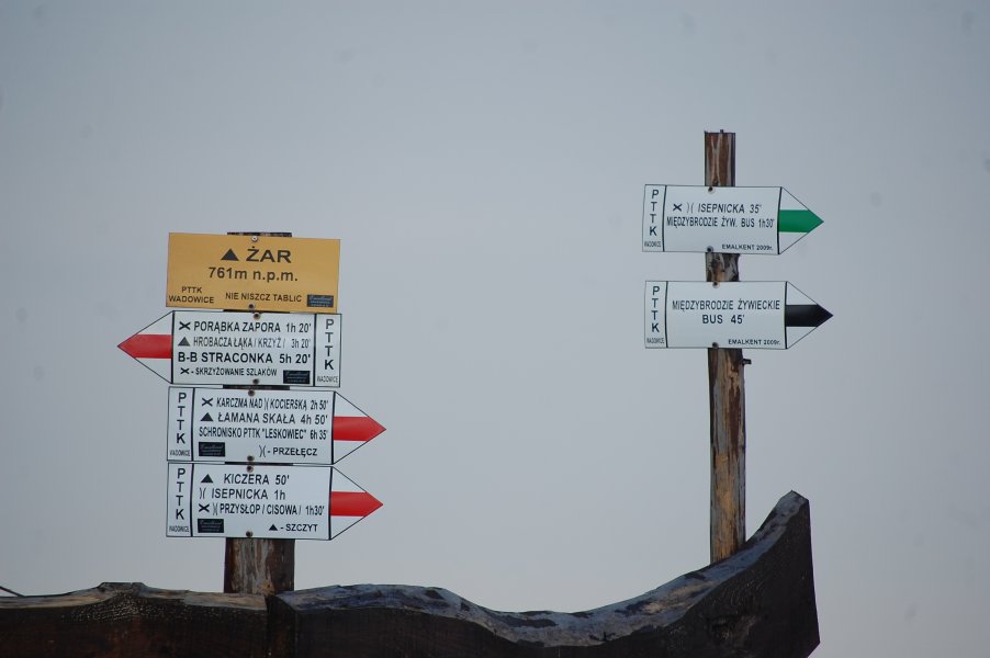
 Żar (761 m)
1